
Showing posts with label Sakatah Singing Hills Trail. Show all posts

Tuesday, March 13, 2012

Re-evaluating Faribault's bike trails


I feel that I owe the city of Faribault an apology.

While working for the Free Press in Mankato, I wrote a column a couple of years ago criticizing the Sakatah Singing Hills Trail for being a subpar trail and that it had the potential to be so much more. Among other critiques in the column, I wrote that Faribault did a poor job accommodating visiting cyclists on the Sakatah.

It made sense at the time. I had ridden the Sakatah trail on numerous occasions at that point and the only lasting memory I had of Faribault was the Dairy Queen located on Highway 60 near the outskirts of town. When I did a 2-day bike trip from Mankato to Red Wing (the inspiration behind that column, by the way), my experience with Faribault involved navigating busy roads to get to Highway 3 and narrowly avoiding the wrath of an oncoming semi (ok, it probably wasn't THAT narrow, but still).

The town hardly seemed bike-friendly and there was nary a local eatery or point of interest to be found. I didn't even know that Faribault had a "historic downtown" area until I looked it up on the Web after that trip.

It definitely wasn't the best impression to have about a town and it certainly didn't aid my enthusiasm about moving to Faribault for a new job. When I accepted the position, I chalked up the lack of bike friendliness as an acceptable drawback of the town. I figured I could make regular trips to the Twin Cities if I wanted to bask in a cycling culture. Besides, after last summer's back roads adventure to Lanesboro, I'm convinced I can make any town accommodating to my biking addiction (provided it isn't comprised entirely of interstate roads).

However, after settling in at Faribault for a couple months and doing some research  on bike trails for a story I wrote for the Faribault Daily News' annual Profiles publication (coming out this week!), I've come to discover that a lot of the stuff I wrote in that column was uninformed and misguided.

For one thing, the notion of charging a daily fee for riders on the Sakatah (a suggestion I made in the column after spending some time on the wonderful Cannon Valley Trail) is an impossibility because the Sakatah is a state-ran trail and thus gets maintained by state funding. The Cannon Valley Trail, on the other hand, is a privately owned trail and is maintained almost entirely through those daily rider fees, meaning they don't have to wait in line with other state projects for funding.

For another thing, I've come to discover that the Faribault isn't so bad when it comes to cycling. As a matter of fact, it more than holds its own.

I came across the Straight River Trail during a cold winter run in January near the downtown area. I didn't think much of it at the time, mostly because my extremities were freezing and I wanted to get home. But after browsing through Google Maps (a great starting point to find bike trails, by the way), I discovered that the trail was a lot more than a brief pathway connecting a few city blocks. It encircles nearly half the town, stretches more than four miles and runs right past several downtown restaurants, the Rice County Fairgrounds and the local disc golf course.

While out biking the other day, I also discovered that one of the side extensions of the trail links up with some of the paths on the south end of the River Bend Nature Center. I didn't take the time to explore the park's trail system extensively, but judging by the maps,  the RBNC will definitely be seeing a lot of me this spring/summer. Aside from the Straight River Trail, I've also found a few other smaller recreational trails in town, most notably on the north end of town between Hulett and Park Avenue.

Really, the infrastructure is in place for Faribault to be a great cycling town. There's good scenery, good points of interest and a logical mapping to avoid the traffic of major roadways. I don't see it topping Mankato as the best cycling town on the Sakatah Trail (sorry, I have a soft spot for that town), but with a little work it could easily turn itself into another Northfield, a town that has made cycling and pedestrian-friendly walkways a point of emphasis in its downtown area.

The biggest step forward from here for Faribault is to link up its in-town trail system with the Sakatah in a way that invites cyclists to spend some time downtown. As I've learned from both my research for the story and getting a general feel for the town, that step is already in progress.

According to an article last fall in the Faribault Daily News, the construction of a pedestrian underpass between Highway 21 and Highway 3 is in progress and will be completed sometime this summer. The project also includes linking the underpass with the trail near Hulett Avenue and overhauling the intersection with a traffic light, turn lanes and a realignment of Park Avenue.

Once that project is complete, city planners will turn their attention to linking the underpass with both the Straight River Trail and the Sakatah Trail. Future projects related to those goals include building a trail through North Alexander park (funding is already in place for it) and constructing a bridge over the Cannon River to reach the Sakatah Trail facility (no funding in place, but I'm told its in the "design phase").

Beyond their goal to link all the trails of Faribault together, these projects are also tied to the Mill Towns Trail, a planned recreational trail between Faribault and Cannon Falls that will eventually link up more than 80 miles of trails (factoring in the Sakatah and Cannon Valley trails).

At the risk of rehasing the story I wrote for Profiles (I'll either post a link to it or post it directly on my blog after it's published) and making this blog entry longer than it already is, I won't go into too much detail about Mill Towns.

Still, after taking all of this into account, it's pretty safe to say that my first impressions of Faribault were incorrect.

So Faribault, I hope you can accept my apology. Your town definitely isn't a black hole for cyclists that I thought it was, and I look forward to exploring more of you in the future.

Saturday, December 31, 2011

New year, new beginnings

Not really conducive to the tone of
my blog post, but I figured my readers
would enjoy a little Calvin & Hobbes.
Well Mankato, it's been fun.

After 3 1/2 years of biking on the Red Jacket Trail and doing training runs up Glenwood Avenue, my residency in the scenic Minnesota River town came to an end yesterday. I am now *mostly* moved in at my new apartment in Faribault and I'll be starting my new job as a page designer for the Faribault Daily News and Northfield News on Jan. 9.

I have mixed emotions about moving away from Kato. I'm obviously not thrilled about leaving the city's blossoming bike culture, as it was a big part of what got me interested in cycling in the first place. I'm also a little downtrodden about moving away from the downtown location I was previously located at. Loud noise from the bars notwithstanding, it was pretty nice to be within walking distance of work, the post office, the grocery store, the library and several decent restaurants.

On a larger scale, it's also a little unnerving to be moving away from a place I've become so accustomed to over the years. I know it's not a good idea to get overly complacent with a situation, particularly in a career as volatile as journalism. But it's hard to avoid when you find so many things to enjoy about a community, which was definitely the case with me in Mankato.

On the other hand, as George Harrison once said: "All things must pass." Despite being nervous about the unknown, I'm excited for the change that comes with a new town and a new job. I don't know much about Faribault aside from its association with the Sakatah Singing Hills Trail, but I'm looking forward to getting acquainted with the community and seeing what the town has to offer. I'm also anxious to continue my career in journalism and get back into a routine that includes work (sorry, but eight weeks of being unemployed is more than enough).

I suppose it's only fitting that the new job and new town would come about at this time of year. New Years has always been a time of new beginnings and resolutions to better yourself in the coming year.

It's too early to tell if I'll grow fond of Faribault like I did with Mankato, but my resolution for 2012 is to make the best of the situation and put forth my best effort at my new job.

Happy New Years everyone!

***Note: With my new location, the focus of my blog will shift from being Mankato-centric to being more oriented toward Faribault readership. However, due to the two towns relative proximity to one another, I will be sure to keep my readers updated if any big news happens out of Mankato in the health & fitness realm.

Wednesday, August 24, 2011

Learning the Loops: Sakatah/Madison Lake


Note: This is Part 3 of a four-part series on the bike loops listed in the Greater Mankato Visitors Bureau's biking/hiking trails map

Distance: About 15 miles.

Directions: Like the other loops, it all depends on where you want to start from. According to the DNR website, a section of the Sakatah Singing Hills Trail is currently closed between Lime Valley Road and Highway 22 until the end of August to replace a bridge, install a large culvert and replace/repair several smaller culverts. Since the parking lot along Highway 22 is also closed, I'd recommend starting from the River Hills Mall parking lot, biking on the path along Highway 22 and linking up with the Sakatah Trail after it crosses County Road 12. Once you reach the trail, turn right and head east to Madison Lake. Once you get to Madison Lake, take a left on Main Street (the road just before reaching the Trailblazer Bar & Grill) and then take an immediate left onto County Road 26. Follow that for about 7 miles until the road intersects with 589th Ave. At that point, take a left, follow the curve to the right onto 227th Street and follow that until you see the Sakatah Trail along the side of the road.

Once the the repair work is done along the Sakatah Trail, I'd recommend starting from the trail head parking lot on Lime Valley Road or at the parking lot located along Highway 22.

Recent wrinkle: A bike path was recently built that links the Sakatah Trail and County Road 12 about a mile east of Mankato. It runs runs parallel to 589th Ave. If you're on the Sakatah Trail, this is the street where the bridge is being built over the railroad tracks. If you're on the back roads portion of the loop, it's the street where Ron's Auto Repair is located. I'm not quite sure how the path adds to this route (the Sakatah Trail and County Road 12 already cross paths in Mankato), but it's another option.

Notes on the route: Might as well call this the "lake loop." Aside from Madison Lake, you'll bike past three other lakes (Ballantyne, Gilfillin and Eagle) in the 15-mile ride and you'll see Eagle Lake twice.

Difficulty-wise, at 15 miles, it's far and away the shortest and easiest loop of the four. Unless you're starting from the Sakatah Trail head (again, not an option at this point because that stretch of trail is closed), the only inclines you'll encounter are a few rolling hills on County Road 26. There isn't a lot of wind cover, but as I've mentioned before, part of the appeal of biking a loop is that a head wind for one stretch can quickly become a tail wind. Since half of the loop takes place on a bike trail and most of the other half sticks to one road, it's also pretty easy to navigate.

I would also consider this loop to be the safest of the four. The back roads on it are well-maintained roads with low traffic, wide shoulders and no problematic intersections to speak of. Ironically, the biggest safety concern of the entire loop used to be on the Sakatah Trail when
trail users had to cross the railroad tracks and bike on a dirt however. However, that concern was resolved earlier this year when the trail was rerouted to run parallel with the bridge being built over the railroad (pictured right). Highway 22 isn't the safest road to cross, but once the repair work is finished, that won't be an issue.

Fair warning: There are no bike shops on this loop or in Madison Lake, so be sure to pack a repair kit just in case. I found this out the hard way when I got a flat tire in Madison Lake last fall and had to call a friend to come pick me up.

Places to eat along the route: Since the Mankato portion of this loop is on the outskirts of town, I'll keep the eating options confined to Madison Lake. With that in mind, there's two major spots to grab a bite in town: The Trail Blazer Bar & Grill and the Boatlanding Restaurant and Resort.

The Trail Blazer was a bike trip destination of mine for a blog post last summer, so I won't waste much space rehashing what I liked about it. The food is very reasonably priced, they have regular drink specials and the atmosphere has a cool fisherman's vibe to it (they also have some interesting wooden statues to glance at, some of which can be seen on the left side of their website).

The Boatlanding Restaurant and Resort is an eating spot I'm relatively unfamiliar with. I've biked past it and hung out on the beach in the resort, but that's about it. According to locals I talked to, the restaurant is known for making delicious pizzas and having a sizable spread for Sunday brunch. It's also known for having surprisingly decent prices on meals for a restaurant that's linked to a resort. The resort's website can be found here, but despite having a restaurant tab, it doesn't have anything listed about their menu or food prices.

Things to see/do along the route: I haven't attempted it yet, but if you can figure out how to pack a fishing pole on your bike, there's probably some pretty good fishing spots along this route (after seeing a RAGBRAI rider tow a keg with his bike last summer, I'm convinced anything is possible). I've had good luck with darkhouse spearfishing on Ballantyne in the past and I know that Madison Lake is one of the more popular fishing holes in the area. Though my co-worker Doug Monson might be the person to ask about area fishing prospects.

Beyond that, the plethora of lakes on this loop also has the inviting prospect of stopping off somewhere to cool down in the water. I've already mentioned the beach on Madison Lake, but according to the loop map, the Eagle Lake public access off County Road 26 is also a viable option. Based on my own experience, I can say that the public access area has relatively clean water and isn't too rocky to walk on.

Beyond fishing and swimming, this loop also has a camping option if you're looking to make it an overnight trip. The Sakatah Trail Campsite (located right next to the Trail Blazer) has tent camping for $15 per night.

Possible ways to expand the loop: The Sakatah Trail runs all the way east to Faribault, so that's a pretty straightforward option to lengthen your ride. The best place I know of to eat along the trail between there and Faribault is Tucker's Tavern in Elysian. Fantastic burgers and enough Vikings memorabilia to make you bleed purple and gold. There's also a disc golf course in Morristown if you're willing to pack a frisbee for the ride.

If your looking for off-trail expansion options, try biking past the Sakatah campground in Madison Lake and taking a left onto 1st Street/County Road 26. That will lead you past Duck Lake into the Lake Jefferson/Lake Henry area. From there, you can either take looping back roads back to Mankato or continue on County Road 15 to Cleveland, home of Kokomo's Bar & Grill.

Tuesday, May 10, 2011

Sakatah and Cannon Valley trails to be linked


Recreational cyclists in Mankato rejoice: There will soon be a trail long enough for even the most hardcore of riders. Heck, it almost stretches into another state!

While searching for Minnesota bike trails the other day, I came across a website for the soon-to-be-built Mill Towns Trail. When completed, Mill Towns will stretch nearly 30 miles from Faribault to Cannon Falls and will link the Sakatah Singing Hills and the Cannon Valley trails.

According to the trail's website, construction has already begun in Northfield, and construction in Faribault is due to begin this summer. However, there is no timetable for the trail's completion as a whole, as construction plans are likely to hampered by state-wide budget restraints.

Regardless of timetable, the Mill Towns Trail is definitely something for southern Minnesota cyclists to get excited about. Not only is it showcasing a wonderful cycling town in Northfield, but a completed Mill Towns Trail means that cyclists would be able to bike all the way from Mankato to Red Wing on bike paths. And if you include Mankato's Minnesota River and Red Jacket trails, that would combine to be roughly 100 miles of non-stop paved trails.

Needless to say, you might want to pack a lunch if you plan to bike the whole thing at once.

Monday, April 18, 2011

Mankato trail updates, bike column and other musings

Just a few quick notes:

  • Here is a link to a column I wrote in today's paper about my experience of grocery shopping on a bike. Anybody who read my blog post on the topic should enjoy it. Unlike the blog entry, it's less about the groceries I was able to get (i.e. no grocery lists or pictures of groceries spread out on my dinner table) and more about the strategy and mindset I used for it.
  • Kenya's Geoffrey Mutai broke the world record today for fastest marathon time, completing the Boston Marathon in 2 hours, 3 minutes and 2 seconds. His time bested Haile Gebrselassie's previous record -- set in 2008 in Berlin -- by almost a full minute. Because the race had a strong tailwind, and because the course is predominantly downhill, Mutai's time won't be recognized as the record by track's international governing body. Tailwind or no tailwind, it's pretty incredible to average a 4:42 mile for an entire marathon. I only know a handful of people who can run a SINGLE MILE at that speed.
  • An extensive amount of biking in the area over the past few days has revealed the following trail updates:
  1. The Minnesota River Trail is still mostly closed due to high river levels. However, after looking at the trail from the viewing pier at Riverfront Park, it likely won't be closed for long. The river level is gradually dropping and only small sections of the trail remain under water.
  2. The new support pier at the Red Jacket trestle bridge is still under construction, so trail users still have to use the detour on the Highway 66 bridge across the Le Sueur River if they want to continue on to Rapidan. According to the Blue Earth County Communicator newsletter, funds have been obtained for the project through FEMA Emergency Disaster Assistance and the bridge should be completed by fall 2011.
  3. A section of the Sakatah Singing Hills Trail just east of Mankato that had previously been under construction has been completed, making the area considerably safer for trail users. Previously, the trail required users to cross the railroad tracks in order to continue on toward Madison Lake. However, the trail now links up with a newly-constructed overpass bridge that crosses that tracks without interrupting the trail. Even better: there are no longer any unpaved sections of the trail for users to endure. I wrote last fall that the Sakatah needed a lot of work to make it a premier regional trail. Well, this was a big step in the right direction.

Sunday, October 17, 2010

River valleys and bike trails: A 2-day trip to Red Wing

Some scattered thoughts about a 2-day bike trip I took to Red Wing last week:

  • The route I took can be broken down into four parts. I took the Sakatah Singing Hills Trail from Mankato to Faribault. From there, I hopped on Highway 3 and headed north to Northfield. Once in the town of Oles and Knights, I went west on Highway 19 to Cannon Falls (map between Faribault and Cannon Falls here). After that, it was a simple 20-mile jaunt on the Cannon Valley Trail into Red Wing. Collectively, it equated to being about 90-95 miles of biking one way and close to 200 miles both ways. A minuscule amount compared to what Eric and Christie Nelson pedaled (who are now back in Mankato after a 14,000-mile ride, congrats you two!), but a decent 2-day trip.
  • My reasons for taking the trip were simple. I had a couple days off in a row from work and was getting bored with the everyday rut I was in. It seemed like everyday revolved around either work or getting a good training run in; not my kind of routine. Aside from all that, I read about the Cannon Valley Trail in the bike trails book I rented from the library and wanted to see if I could make it there from the end of the Sakatah trail. Cannon Falls (the start point of the Cannon Valley Trail) is less than 30 miles from Faribault on back roads; turns out it was very feesible on a bike.
  • Since it was a 2-day trip, I had to pack a change of clothes and a tent on my bike somehow. I resorted to buying a $20 bar rack at Wal Mart and bungeed everything to it (see photo). I also packed a small bike repair kit on the front of my bike. The one hitch in this plan was that the rack wasn't designed for my bike and needed to be bungeed down to keep it from moving. Next time, I think I'll try someplace other than Wal Mart to do last-minute bike shopping.
  • I was initially going to use this trip as a way to explore the notion of connecting the Cannon Valley and Sakatah trails at some point. However, as the trip progressed, it turned into more of a juxtaposition of how much better shape the Cannon Valley Trail is in. See my column in Sunday's paper for further details.
  • Best part of the trip: Finding a random bar called Chuggers in downtown Cannon Falls to watch the Vikings-Jets game after setting up camp for the night. Good atmosphere, passionate fans, decent drink prices and an entertaining Monday night game. Not sure if I've ever head that many verbal barbs aimed at Brad Childress in one 3-hour stretch (which is saying something).
  • Worst part of the trip: The 16-mile stretch of road between Northfield and Cannon Falls. Rolling hills, no shoulder, busy traffic and curse-worthy swirling winds. Let's just say the beer at Chuggers tasted a whole heck of a lot better after that ordeal.
  • 2nd worst part of the trip: Paying $25 for a non-electric campsite to set my tent up for a night at the Cannon Falls Campground. I understand campsites need to make money, but charging the rate of a cheap hotel room for tent camping is a little ridiculous. I spent the rest of the trip wondering if I could have set up camp on the side of the road without being noticed.
  • Despite Red Wing being the destination of the trip, Northfield was probably the coolest town I visited. It's home to a very quaint (and bicycle friendly) downtown area by the Cannon River, complete with quirky shops and tasty local eateries. I looked around the mall there for awhile and, on the suggestion of locals and websites alike, ate at Basil's Pizza Place for dinner. GREAT pizza and very reasonable prices. St. Olaf and Carleton campuses were also fun to look at for awhile. Liberal arts colleges usually have some impressive old-fashioned architecture to admire, and these two were no exception. Considering Northfield is an easy 11-mile jaunt from the Sakatah trail, I might need to make that trip again sometime. The third photo on the right is a picture of Northfield from the viewpoint of the top floor of Larson Hall at St. Olaf. Beyond the buildings at St. Olaf, you can see Carleton College off in the distance on the left and can see the downtown area of Northfield as well.
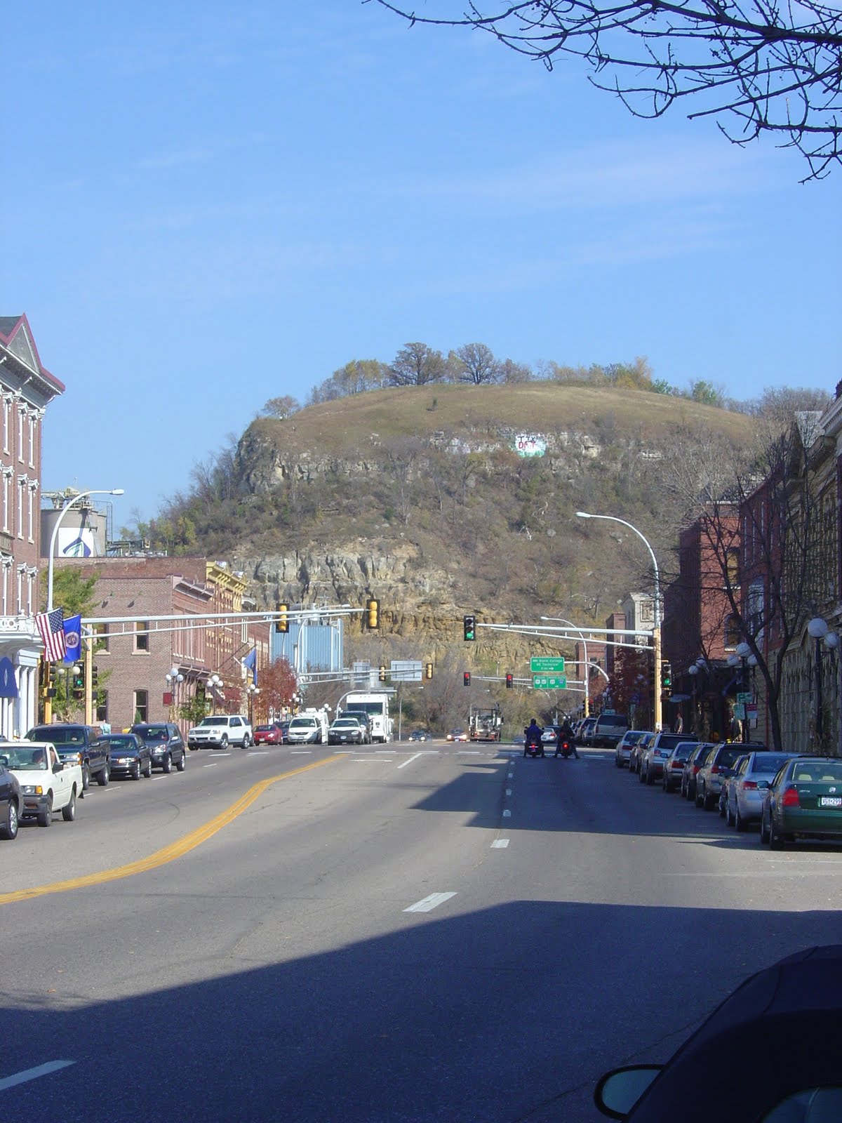
  • I wish I would've had more time to explore Red Wing. I really only had about a 3-hour window to explore the town, and part of that was spent eating lunch at Liberty Restaurant downtown (recommended by locals; I wasn't a huge fan of it, too pricey). Red Wing apparently has some great hilltop vantage points from Memorial Park and Barns Bluff (pictured in the background in the first the photo, which is of Main Street in Red Wing). However, I didn't have the time to hike up to either of them. Instead, I looked at a few shops downtown, biked over the Mississippi River into Wisconsin, and checked out the riverfront park. Definitely fun, but there was more to see in that town.
  • As par for the course with my other bike adventures, this one was not without equipment problems on my two-wheeled companion. My rear-wheel brake lever actually detached from the handlebar between Northfield and Cannon Falls (see photo), making it impossible to use that brake for the rest of the trip (not the safest biking I've ever done). Additionally, the extra weight of my gear caused a rear-wheel spoke to break on the second day of biking. Thankfully, I was able to locate a bike shop in Cannon Falls (really more of an old-timey hardware store, really wish I would've got a picture of it) to fix my spoke and duct tape the brake lever back to my handlebars.
  • The trip was initially intended to be a 2-day adventure where I would leave late Monday morning and get back Wednesday around lunch. However, thanks to a combination of a head lamp and my legs getting second wind in Faribault, I managed to make it back into Mankato late Tuesday night. Collectively, Tuesday a 120-mile biking day, with the majority of the miles pedaled after 1 p.m. Not the best idea in retrospect, I felt like crap the next couple days.
 

yaz